Cartography
Photography
Cartography
Photography
Alex Machin-Mayes | Maps & Images

Earthquakes - Esri Cartography MOOC

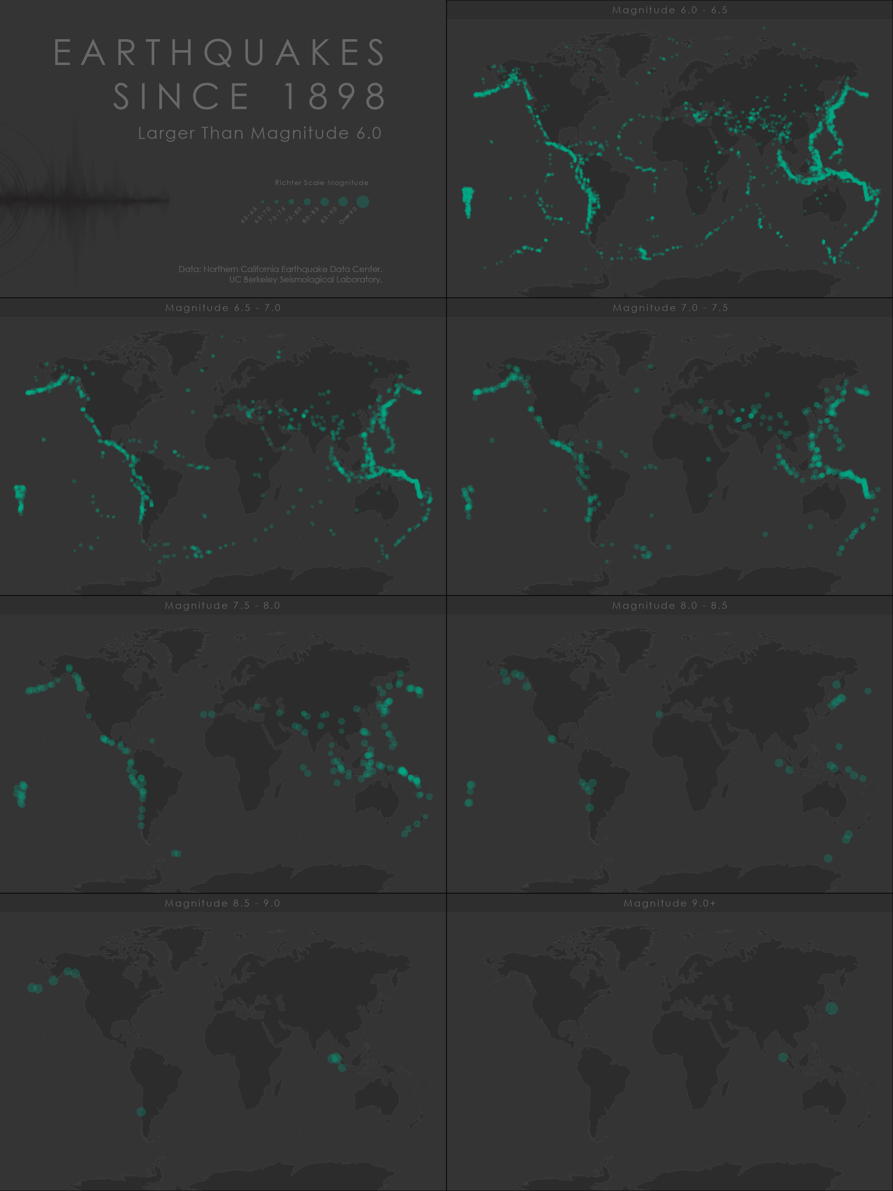
Small multiples map created in ArcPro showing earthquakes by range of magnitude since 1898 using proportional symbology.

You may also like

Bivariate Choropleth
Fly-Through Animation - Oso, WA
Pacific to Palouse
Relative Elevation Model
This Map Lies
REM - Daniel Coe Inspired
Tokyo Streets
Python Automation - IDW & OLS Analysis
Soil Conductivity
Wetlands Delineation
↑Back to Top
Powered by Adobe Portfolio